
Dispatch from the MethaneSAT Launch: A New Era of Emissions Transparency and Accountability
As more "eyes in the sky" make their way into orbit, methane emissions transparency is no longer a pipe dream.
Last week, under blue skies in coastal California, I attended an explosive event in global climate action: a rocket launch. This rocket came with a special payload — a new methane-detecting satellite destined to orbit above Earth and patrol for emissions. To say it was a spectacular moment is an understatement.
If you’ve never seen the launch of a Falcon 9 rocket up close, the experience is visceral and breathtaking. Even though we were set up almost three miles away at the Vandenberg Space Force Base, the anticipation and nervous energy buzzing among the launch partners made us feel like we were in the front row of a grand stage.
As we eagerly awaited signs from the launchpad that the production was underway, a spark of orange quickly turns into a pillar of fire as the rocket slowly lifts from the ground. A few seconds later, a guttural roar fills the landscape as the rocket climbs higher. The distance, as well as the strange relationship between light and sound, begin to play tricks on the naked eye as the rocket arcs South, the exhaust plume creating a swirling vortex of orange and white, and the once deafening sound turns into a deep rumble.
The initial moments of MethaneSAT’s launch aboard a Falcon 9 rocket. Source: Josh Henretig
I had the honor of representing RMI at the Environmental Defense Fund’s (EDF) groundbreaking launch of MethaneSAT, a new high-resolution satellite that is able to map, measure, and track methane emissions on a global basis (fifteen times a day, to be exact) with unprecedented precision, offering a comprehensive view of methane emissions. Methane, a powerful climate pollutant, is over 80 times more powerful than CO2 in heating the planet. It’s also invisible to the human eye and often emitted in high concentrations across many geographies, making it a prime target for satellite imaging.
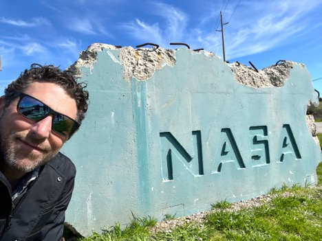
Josh Henretig at the Vandenberg Space Force Base, host of the MethaneSAT launch. Source: Josh Henretig
Advancing methane emissions visibility
On my team at RMI, we understand that people and organizations around the world have historically lacked the data needed to act decisively to advance net-zero goals. Without the ability to openly identify, quantify, or attribute greenhouse gas emissions, it’s impossible to track progress or hold stakeholders accountable. This is particularly true for methane emissions.
Methane has a few top anthropogenic sources: agriculture, waste, and the energy sector. The energy sector — including oil, natural gas, coal and bioenergy — accounts for nearly 40 percent of man-made methane emissions. It is also one of the main focuses of my work at RMI.
Methane emissions from oil and gas operations can occur from venting and flaring — basically when the gas is inefficiently combusted or released inadvertently or on purpose. Leaks can be large or small, intermittent or persistent, accidental or intentional. Methane can escape from tanks, compressors, pipelines, or other equipment. In part because methane is lighter than air and readily dissipates, it’s hard to measure methane concentrations on the ground, making it advantageous for companies to under-report their climate impacts. As such, these emissions are frequently omitted from self-reported emissions inventories. For example, the International Energy Agency finds that existing oil and gas company reporting is 95 percent lower than estimates for 2023.
Satellite imaging is taking off — quite literally. There are already government satellites, like EMIT and TROPOMI reporting back valuable data. MethaneSAT will add new climate intelligence. And when Carbon Mapper (a first-of-its-kind coalition of public, private, and nonprofit entities — including RMI) launches two satellites for the first time later this year, the spotlight will be on point source methane super emitters. Together, these satellites will form a “system-of-systems” that can help spot and stop methane leakage around the globe.
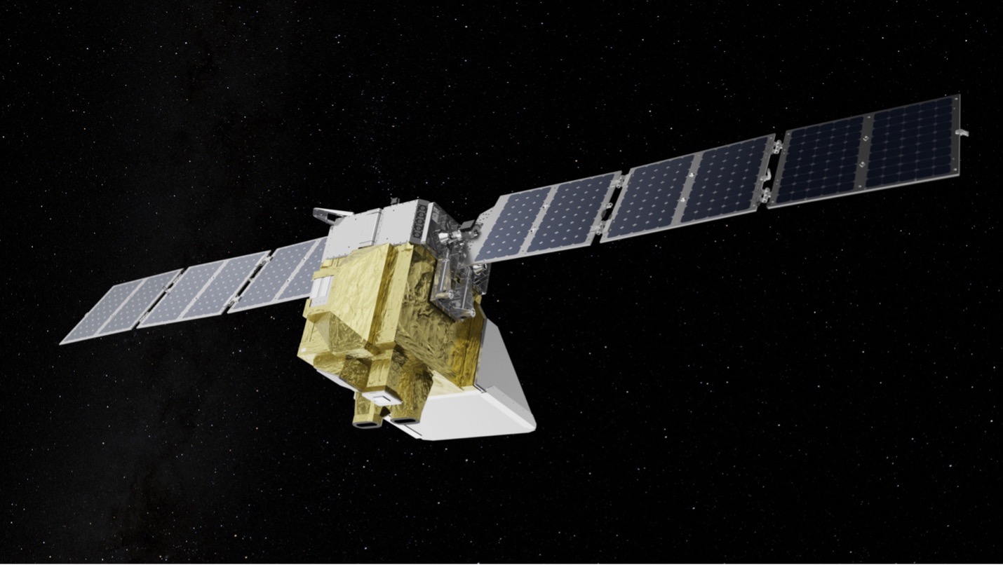
A digital model of the MethaneSAT instrument. Source: Environmental Defense Fund.
With satellite data, companies, financial actors, regulators, and citizens can advance climate action. This can entail independently certified gas (MiQ), buyers-sellers alliances, new fees on methane exceedances (thanks to the US Inflation Reduction Act), and more. Using visibility, policy, and market activation tools, we can reduce methane leakage to below 0.2 percent, which is critical to meet methane reduction pledges and reduce the risk of runaway climate change.
Why nonprofit satellites matter
The majority of satellites in operation today are public or for-profit. MethaneSAT and Carbon Mapper are different — they stem from nonprofit organizations. Unlike satellites launched for scientific research or commercial application, the mission of nonprofit satellites is first and foremost to advance climate action. Already, public data portals are taking government satellite data to identify, quantify, and chart methane leaks worldwide.
Making methane visible and providing public emissions data that can be independently verified is the key to climate action in this decisive decade. The broader the set of stakeholders who can access methane satellite data, the more robust the market will be for major methane mitigation solutions.
Different tools for different jobs
Different satellites collect different information, whether that be in geographic scope or granularity — and the number of satellites dedicated to monitoring emissions is growing. In 2026, the European Space Agency plans to launch two satellites dedicated to monitoring atmospheric CO2. This year, there will be two more methane-focused satellites joining the flock: with a Japanese program complementing the aforementioned Carbon Mapper satellites. Carbon Mapper’s planned constellation of satellites will complement MethaneSAT’s ability to capture images spanning larger areas (each picture covers 125 x 125 miles), by specializing in monitoring high priority regions for high emission point sources to provide the granularity needed to pinpoint and fix emissions at individual facilities.
As the data and insights provided by satellites increase, the more nuanced the decision becomes to invoke the capabilities of one satellite over another. To choose the right tool for the right job, one must understand what each satellite is designed to do, and how its data can help decision makers meet their goals (RMI’s Satellite Point source Emissions Completeness Tool (SPECT) can help with that).
Looking forward (and up)
A new chapter in methane emissions transparency is unfolding rapidly. The growing number of eyes in the sky will enable a new wave of accountability, market mechanisms, and collaboration when it comes to addressing methane emissions. Open and accessible emissions data allows for independent verification of findings by researchers and scientists worldwide. Making this data freely available also allows a broader range of users to access it, which can lead to unforeseen applications of the data, such as citizen science projects or innovative solutions for mitigation efforts.
Better data also means faster policy development. With reliable, accessible data, policymakers can accelerate the development of targeted regulations to curb methane emissions.
Finally, open-source emissions data promotes innovation. When emissions data is transparent, businesses and other innovators can use that data to develop new technologies for leak detection, capture, and utilization, leading to a more robust market for methane mitigation solutions.
As I watched the MethaneSAT launch last week, its white-hot exhaust gas trail slowly fading into the sky, I felt a sense of hope for our planet and the next generation that will inhabit it. Getting a handle on methane emissions represents one of the most immediate and cost-effective opportunities we face to curb climate change now, and the new insights that these satellite technologies represent is our best chance of getting us there.
Working in the climate field, a lot of days can feel like an uphill battle, constantly taking two steps forward and one step back. But today, I can tell my kids we didn’t just take a step towards a safe climate future — we launched in the right direction.